Category:East Peckham
Jump to navigation
Jump to search

village and civil parish in Kent, England  | |||||
| Upload media | |||||
| Instance of | |||||
|---|---|---|---|---|---|
| Location | Tonbridge and Malling, Kent, South East England, England | ||||
| Said to be the same as | East Peckham (Wikimedia duplicated page, civil parish) | ||||
 | |||||
Subcategories
This category has the following 7 subcategories, out of 7 total.
Media in category "East Peckham"
The following 200 files are in this category, out of 538 total.
(previous page) (next page)-
 91 and 93 Pound Road, East Peckham - geograph.org.uk - 2779985.jpg 4,288 × 3,216; 4.82 MB
-
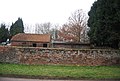 A 19th century brick wall, Bush Rd - geograph.org.uk - 2341682.jpg 640 × 430; 85 KB
-
 A distributary of the River Medway - geograph.org.uk - 2732124.jpg 640 × 430; 127 KB
-
 A228 - crossing the River Medway - geograph.org.uk - 3151455.jpg 640 × 428; 62 KB
-
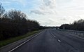
 A228 - geograph.org.uk - 2372341.jpg 640 × 266; 21 KB
-
 A228 - Maidstone 11 miles - geograph.org.uk - 3151442.jpg 640 × 428; 62 KB
-
 A228 Boyle Way - geograph.org.uk - 3837254.jpg 1,600 × 993; 237 KB
-
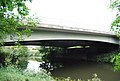 A228 bridge, River Medway - geograph.org.uk - 2740109.jpg 640 × 430; 78 KB
-
 Access road - geograph.org.uk - 4345421.jpg 640 × 480; 119 KB
-
 Addlestead Road, East Peckham - geograph.org.uk - 4889766.jpg 3,264 × 2,448; 1.83 MB
-
 Addlestead Tavern, East Peckham - geograph.org.uk - 4889769.jpg 3,264 × 2,448; 2.09 MB
-
 Alongside the River Bourne at Little Mill - geograph.org.uk - 5020815.jpg 4,608 × 3,456; 3.4 MB
-
 Apple orchard by Bells Farm Lane - geograph.org.uk - 2345829.jpg 640 × 430; 66 KB
-

-
 Autumnal colours near Roydon Hall - geograph.org.uk - 1568729.jpg 640 × 430; 155 KB
-
 Autumnal colours near Roydon Hall - geograph.org.uk - 1568731.jpg 640 × 430; 183 KB
-
 Bardsley Close, Hale Street - geograph.org.uk - 2339894.jpg 640 × 430; 61 KB
-
 Barn across a field, East Peckham - geograph.org.uk - 2367840.jpg 640 × 430; 45 KB
-
 Barn at Crowhurst Farm - geograph.org.uk - 2874608.jpg 640 × 480; 87 KB
-
 Barn at Kent House Farm - geograph.org.uk - 2521406.jpg 640 × 480; 159 KB
-
 Barn at Stilstead - geograph.org.uk - 2366045.jpg 640 × 430; 70 KB
-
 Barn on the edge of East Peckham - geograph.org.uk - 2367857.jpg 640 × 430; 56 KB
-
 Barn, Bells Farm - geograph.org.uk - 2346070.jpg 640 × 430; 70 KB
-
 Barn, Bells Farm - geograph.org.uk - 2347628.jpg 640 × 430; 60 KB
-
 Barn, Brook Farm - geograph.org.uk - 2339935.jpg 640 × 430; 45 KB
-
 Barn, Crowhurst Farm - geograph.org.uk - 2344818.jpg 640 × 390; 55 KB
-
 Barn, Pond Farm - geograph.org.uk - 2345003.jpg 640 × 430; 72 KB
-
 Barn, Pond Farm - geograph.org.uk - 2345006.jpg 640 × 430; 63 KB
-
 Barn, Strettit Farm - geograph.org.uk - 2370924.jpg 640 × 430; 41 KB
-
 Beadles Forge, Forge Farm - geograph.org.uk - 1569612.jpg 640 × 430; 159 KB
-
 Bell's Farm Lane - geograph.org.uk - 2347629.jpg 640 × 430; 72 KB
-

-
 Bells Farm Lane - geograph.org.uk - 2344801.jpg 640 × 430; 57 KB
-
 Bells Farm Lane - geograph.org.uk - 2345018.jpg 640 × 430; 64 KB
-
 Bells Farm Lane - geograph.org.uk - 2345802.jpg 640 × 430; 55 KB
-
 Bells Farm Lane - geograph.org.uk - 2346013.jpg 640 × 430; 73 KB
-
 Bells Farm Lane - geograph.org.uk - 2346023.jpg 640 × 430; 67 KB
-
 Bells Farm Lane - geograph.org.uk - 2346048.jpg 640 × 430; 77 KB
-
 Bells Farm Road, near East Peckham - geograph.org.uk - 4889597.jpg 3,264 × 2,448; 2.7 MB
-
 Bells Farm Road, near East Peckham - geograph.org.uk - 4889602.jpg 3,264 × 2,448; 2.4 MB
-
 Bells Farm Road, near East Peckham - geograph.org.uk - 4889729.jpg 3,264 × 2,448; 2.01 MB
-
 Bells Farm Road, near East Peckham - geograph.org.uk - 4889731.jpg 3,264 × 2,448; 1.86 MB
-
 Bells Farmhouse - geograph.org.uk - 2347619.jpg 640 × 430; 62 KB
-
 Bells Farmhouse - geograph.org.uk - 2347623.jpg 640 × 430; 72 KB
-
 Below the East Peckham bypass (A228) - geograph.org.uk - 2740108.jpg 640 × 430; 57 KB
-

-
 Bourne House, Little Mill - geograph.org.uk - 2367395.jpg 640 × 430; 69 KB
-
 Bower Mount, Snoll Hatch Rd - geograph.org.uk - 2370888.jpg 640 × 430; 79 KB
-
 Bramley Road, East Peckham - geograph.org.uk - 4660465.jpg 2,272 × 1,704; 793 KB
-

-
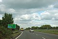
 Branbridges Bypass (A228) - geograph.org.uk - 2371082.jpg 640 × 401; 27 KB
-

-
 Branbridges Rd, Branbridges - geograph.org.uk - 2371079.jpg 640 × 262; 28 KB
-

-
 Branbridges Road, East Peckham - geograph.org.uk - 3638331.jpg 640 × 360; 64 KB
-
 Bridge in the trees - geograph.org.uk - 2740119.jpg 640 × 430; 128 KB
-
 Bridge over the River Bourne - geograph.org.uk - 5020725.jpg 4,608 × 3,456; 3.61 MB
-
 Bridge over the River Medway - geograph.org.uk - 2732104.jpg 640 × 430; 83 KB
-
 Bullen Lane at the junction of Hatches Lane - geograph.org.uk - 4963454.jpg 2,304 × 1,728; 853 KB
-
-
 Bullen Lane, East Peckham - geograph.org.uk - 3636831.jpg 640 × 360; 75 KB
-
 Bullen Lane, East Peckham - geograph.org.uk - 3636837.jpg 640 × 360; 67 KB
-
 Bullen Lane, East Peckham - geograph.org.uk - 4889759.jpg 3,264 × 2,448; 1.5 MB
-
 Bullen Lane, East Peckham - geograph.org.uk - 4889760.jpg 2,901 × 2,177; 1.51 MB
-
 Bullen Lane, East Peckham - geograph.org.uk - 4889762.jpg 3,264 × 2,448; 2.14 MB
-
 Bullen Lane, East Peckham - geograph.org.uk - 4963456.jpg 2,304 × 1,728; 821 KB
-
 Bullen Lane, East Peckham - geograph.org.uk - 4963477.jpg 2,304 × 1,728; 825 KB
-
 Bullen Lane, East Peckham - geograph.org.uk - 4963506.jpg 2,304 × 1,728; 829 KB
-
 Bullen Lane, near East Peckham - geograph.org.uk - 3637012.jpg 640 × 360; 64 KB
-
 Bush Rd - geograph.org.uk - 2342844.jpg 640 × 430; 66 KB
-
 Bush Rd - geograph.org.uk - 2342873.jpg 640 × 430; 54 KB
-
 Bush Rd north of East Peckham - geograph.org.uk - 2341668.jpg 640 × 430; 84 KB
-
 Bush Road, East Peckham - geograph.org.uk - 4889753.jpg 3,264 × 2,448; 1.77 MB
-
 Bush Road, East Peckham - geograph.org.uk - 4889756.jpg 3,264 × 2,448; 1.9 MB
-
 Bush Road, Peckham Bush - geograph.org.uk - 3637010.jpg 640 × 360; 61 KB
-
 Bush, Blackbird ^ Thrush, East Peckham - geograph.org.uk - 4889758.jpg 3,264 × 2,448; 2.68 MB
-
 Canoe view of the River Medway - geograph.org.uk - 4606231.jpg 480 × 640; 72 KB
-
 Canoe view of the River Medway - geograph.org.uk - 4606233.jpg 640 × 480; 85 KB
-
 Canoe view of the River Medway - geograph.org.uk - 4606235.jpg 480 × 640; 80 KB
-
 Canoe view of the River Medway - geograph.org.uk - 4606237.jpg 640 × 480; 63 KB
-
 Canoe view of the River Medway - geograph.org.uk - 4606238.jpg 640 × 480; 79 KB
-
 Canoe view of the River Medway - geograph.org.uk - 4606240.jpg 640 × 480; 79 KB
-
 Canoe view of the River Medway - geograph.org.uk - 4606243.jpg 480 × 640; 65 KB
-
 Canoe view of the River Medway - geograph.org.uk - 4606244.jpg 480 × 640; 83 KB
-
 Canoe view of the River Medway - geograph.org.uk - 4606246.jpg 640 × 480; 70 KB
-
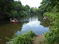
 Canoes on the River Medway - geograph.org.uk - 6233548.jpg 4,000 × 3,000; 4.98 MB
-
 Canoes on the River Medway near East Peckham - geograph.org.uk - 6233552.jpg 4,000 × 3,000; 4.83 MB
-

-

-
 Cars for sale - geograph.org.uk - 2740103.jpg 640 × 430; 51 KB
-
 Caysers Croft, East Peckham - geograph.org.uk - 4967446.jpg 2,304 × 1,728; 864 KB
-
 Chidley Cross Road, East Peckham - geograph.org.uk - 4889767.jpg 3,264 × 2,448; 1.8 MB
-
 Chinese or chips^ - geograph.org.uk - 2370996.jpg 640 × 430; 63 KB
-
 Church Lane - geograph.org.uk - 2339925.jpg 640 × 430; 71 KB
-
 Church Lane - geograph.org.uk - 2339951.jpg 640 × 430; 86 KB
-
 Church Lane, Hale Street - geograph.org.uk - 2339921.jpg 640 × 430; 71 KB
-

-
 Conveyor belt crossing the River Medway - geograph.org.uk - 1159055.jpg 640 × 430; 113 KB
-
 Coppiced trees by the River Medway - geograph.org.uk - 1159047.jpg 640 × 430; 126 KB
-

-
 Corner Cottage - geograph.org.uk - 1201911.jpg 640 × 481; 93 KB
-
 Cornerways, Hale Street - geograph.org.uk - 2339906.jpg 640 × 430; 56 KB
-
 Cornerways, Hale Street - geograph.org.uk - 2371065.jpg 640 × 430; 98 KB
-
 Cottage at Little Mill - geograph.org.uk - 5020382.jpg 4,608 × 3,456; 3.55 MB
-
 Cottage, Bush Rd - geograph.org.uk - 2340120.jpg 640 × 430; 53 KB
-
 Cottages, Snoll Hatch Rd - geograph.org.uk - 2367884.jpg 640 × 430; 70 KB
-
 Country Fires on Bullen Lane, East Peckham - geograph.org.uk - 4962346.jpg 2,304 × 1,728; 823 KB
-
 Countryside north of East Peckham - geograph.org.uk - 2341641.jpg 640 × 430; 37 KB
-
 Court Lane, Bell's Farm Lane - geograph.org.uk - 2347655.jpg 640 × 430; 86 KB
-
 Crossroads, East Peckham - geograph.org.uk - 2370934.jpg 640 × 430; 65 KB
-
 Crowhurst Farmhouse - geograph.org.uk - 2344805.jpg 640 × 430; 107 KB
-
 Crowhurst hop Farm - geograph.org.uk - 2343493.jpg 640 × 433; 51 KB
-
 Crowhurst Hop Farm - geograph.org.uk - 2343494.jpg 640 × 367; 43 KB
-
 Crowhurst Hop Farm, Bullen Lane, East Peckham - geograph.org.uk - 4374435.jpg 1,024 × 768; 230 KB
-
-
 Crown Acres off Old Rd - geograph.org.uk - 2371028.jpg 640 × 430; 73 KB
-
 Crown Acres, East Peckham - geograph.org.uk - 3637077.jpg 640 × 360; 58 KB
-
 Crown Acres, East Peckham - geograph.org.uk - 4660428.jpg 2,272 × 1,704; 903 KB
-
 Derelict building, Branbridges - geograph.org.uk - 2740104.jpg 640 × 430; 80 KB
-
 Derelict buildings, Branbridges - geograph.org.uk - 2740105.jpg 640 × 430; 67 KB
-
 Disused Warehouse - geograph.org.uk - 4333956.jpg 640 × 480; 64 KB
-
 Double footbridge - geograph.org.uk - 1217702.jpg 640 × 480; 130 KB
-
 Drainage ditch by Kent House Farm - geograph.org.uk - 4374483.jpg 1,024 × 683; 236 KB
-
 Ducks at Beltring Hop Farm - geograph.org.uk - 5189889.jpg 3,648 × 2,736; 2.51 MB
-
 E.J. Nye, Hale Street - geograph.org.uk - 2371061.jpg 640 × 430; 56 KB
-
 East Peckham Co-operative Store - geograph.org.uk - 2779942.jpg 4,288 × 3,216; 3.71 MB
-
 East Peckham Library - geograph.org.uk - 1212188.jpg 640 × 480; 87 KB
-
 East Peckham Library - geograph.org.uk - 2370987.jpg 640 × 430; 86 KB
-
 East Peckham Library - geograph.org.uk - 3637050.jpg 640 × 360; 56 KB
-
 East Peckham Methodist Church - geograph.org.uk - 4963286.jpg 2,304 × 1,728; 856 KB
-
 East Peckham Primary School - geograph.org.uk - 2339983.jpg 640 × 430; 58 KB
-
 East Peckham Primary School - geograph.org.uk - 2339986.jpg 640 × 430; 66 KB
-
 East Peckham Primary School - geograph.org.uk - 2339990.jpg 640 × 430; 71 KB
-
 East Peckham Primary School - geograph.org.uk - 2340119.jpg 640 × 370; 65 KB
-
 East Peckham Village Hall - geograph.org.uk - 2780001.jpg 4,288 × 3,216; 3.38 MB
-
 East Peckham village hall - geograph.org.uk - 3637039.jpg 640 × 360; 65 KB
-
 East Peckham Village Sign (Close-up) - geograph.org.uk - 2779929.jpg 4,288 × 3,216; 5.69 MB
-
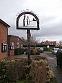 East Peckham Village Sign - geograph.org.uk - 2779922.jpg 3,216 × 4,288; 4.72 MB
-
 East Peckham Village Sign - geograph.org.uk - 4890609.jpg 3,264 × 2,448; 3.07 MB
-

-
 East Peckham, steps up to churchyard - geograph.org.uk - 1969733.jpg 426 × 640; 112 KB
-
 EastPeckhamLittleMill3484.JPG 2,848 × 2,136; 1.34 MB
-
 EastPeckhamLittleMill3486.JPG 2,848 × 2,136; 1.37 MB
-
 EastPeckhamLittleMill3487.JPG 2,848 × 2,136; 1.38 MB
-
 EastPeckhamLittleMill3491.JPG 2,848 × 2,136; 1.27 MB
-
 EastPeckhamLittleMill3492.JPG 2,848 × 2,136; 1.33 MB
-
 EastPeckhamLittleMill3495.JPG 2,848 × 2,136; 1.4 MB
-
 Entrance to Stilstead Farm - geograph.org.uk - 1100782.jpg 640 × 427; 57 KB
-
 Farm track to Brook Farm - geograph.org.uk - 2339938.jpg 640 × 430; 66 KB
-
 Farmland by Bells Farm Lane - geograph.org.uk - 2345813.jpg 640 × 373; 45 KB
-
 Farmland by the A228 - geograph.org.uk - 2709456.jpg 640 × 430; 57 KB
-
 Farmland by the River Medway - geograph.org.uk - 2740110.jpg 640 × 430; 57 KB
-
 Farmland near East Peckham - geograph.org.uk - 2339943.jpg 640 × 430; 49 KB
-
 Farmland near East Peckham. - geograph.org.uk - 2339957.jpg 640 × 430; 50 KB
-
 Farmland near Kent House - geograph.org.uk - 2347651.jpg 640 × 430; 42 KB
-
 Fell Mead, East Peckham - geograph.org.uk - 4660462.jpg 2,272 × 1,704; 787 KB
-
 Field alongside Maidstone Road - geograph.org.uk - 4911892.jpg 4,608 × 3,456; 3.36 MB
-
 Field alongside Old Church Lane, East Peckham - geograph.org.uk - 3025327.jpg 4,000 × 3,000; 4.37 MB
-
 Field by Bells Farm Lane - geograph.org.uk - 2345799.jpg 640 × 430; 60 KB
-
 Field of Maize - geograph.org.uk - 2709454.jpg 640 × 430; 51 KB
-
 Fields and polytunnels west of East Peckham old church - geograph.org.uk - 4423701.jpg 1,600 × 1,064; 236 KB
-
 Fingerpost, near East Peckham - geograph.org.uk - 4889750.jpg 2,448 × 3,264; 2.19 MB
-
 Flints Cottage - geograph.org.uk - 2341681.jpg 640 × 469; 77 KB
-
 Flooded forest by the River Medway - geograph.org.uk - 1159118.jpg 640 × 430; 121 KB
-
 Following the River Bourne - geograph.org.uk - 5020043.jpg 4,608 × 3,456; 3.37 MB
-
 Footbridge across the River Bourne - geograph.org.uk - 5020727.jpg 4,608 × 3,456; 3.52 MB
-
 Footbridge near East Peckham - geograph.org.uk - 4333954.jpg 640 × 480; 133 KB
-
 Footbridge off Church Lane - geograph.org.uk - 2339947.jpg 640 × 430; 91 KB
-
 Footbridge on Greensand Way - geograph.org.uk - 1212194.jpg 640 × 480; 135 KB
-
 Footbridge over A228 - geograph.org.uk - 3151475.jpg 640 × 428; 71 KB
-
 Footbridge over the Medway - geograph.org.uk - 2735591.jpg 640 × 430; 118 KB
-
 Footbridge over the Medway - geograph.org.uk - 2735644.jpg 640 × 430; 110 KB
-
 Footbridge over the River Bourne - geograph.org.uk - 2367427.jpg 640 × 430; 54 KB
-
 Footbridge over the River Medway - geograph.org.uk - 2732103.jpg 640 × 430; 108 KB
-
 Footbridge over the River Medway - geograph.org.uk - 2735641.jpg 640 × 430; 114 KB
-
 Footbridge, Medway Valley Walk - geograph.org.uk - 2732122.jpg 640 × 430; 124 KB
-
 Footpath Bridge - geograph.org.uk - 2731465.jpg 3,072 × 2,304; 2.97 MB
-
 Footpath finger post - geograph.org.uk - 2753805.jpg 4,320 × 3,240; 4.35 MB
-
 Footpath off Addlestead Rd - geograph.org.uk - 2367863.jpg 640 × 430; 74 KB
-
 Footpath off Bush Rd - geograph.org.uk - 2342864.jpg 640 × 430; 96 KB
-
 Footpath off Hale St - geograph.org.uk - 2371048.jpg 640 × 430; 81 KB
-
 Footpath off Old Church Lane - geograph.org.uk - 3063823.jpg 4,000 × 3,000; 4.07 MB
-
 Footpath past Peckham Fields Wood - geograph.org.uk - 1200613.jpg 640 × 481; 117 KB
-
 Footpath sign, Tonbridge Rd - geograph.org.uk - 2366102.jpg 640 × 430; 73 KB
-
 Footpath signposted off Bush Rd - geograph.org.uk - 2341639.jpg 640 × 430; 60 KB
-
 Footpath to East Peckham - geograph.org.uk - 2367823.jpg 640 × 430; 46 KB
-
 Footpath to East Peckham - geograph.org.uk - 2367850.jpg 640 × 430; 67 KB
-
 Footpath to Hadlow - geograph.org.uk - 2780066.jpg 4,288 × 3,216; 6.29 MB
-
 Footpaths near Paddock Wood - geograph.org.uk - 3634002.jpg 640 × 360; 83 KB
-

-
 Former Blue Bell pub at Beltring - geograph.org.uk - 4829769.jpg 640 × 480; 73 KB
-
 Former Seven Mile Lane - geograph.org.uk - 1237357.jpg 640 × 480; 122 KB
-
 Fruit beds by the A228 - geograph.org.uk - 1569575.jpg 640 × 430; 146 KB
-
 Gabion boxes on the River Medway - geograph.org.uk - 1159165.jpg 640 × 430; 90 KB
-
 Garages, Hop Barn, Little Mill - geograph.org.uk - 2366165.jpg 640 × 430; 93 KB
-
 Garages, Hop Barn, Little Mill - geograph.org.uk - 2366169.jpg 640 × 430; 74 KB
-
 Garden Centre, East Peckham - geograph.org.uk - 2214355.jpg 4,320 × 3,240; 3.89 MB
-
 Gravel pit bridge - geograph.org.uk - 2740111.jpg 640 × 430; 101 KB
-
 Gravel Pit, East Peckham, Kent - geograph.org.uk - 1397165.jpg 640 × 480; 79 KB
-
 Gravel Pit, East Peckham, Kent - geograph.org.uk - 890849.jpg 640 × 427; 73 KB


_-_geograph.org.uk_-_2740108.jpg)


_-_geograph.org.uk_-_2371082.jpg)


_-_geograph.org.uk_-_2779929.jpg)


